Best Large Wall World Maps for 2026
If you’re decorating a classroom, office, or home study area, large world maps make a bold and educational statement. This guide highlights top oversized and laminated world maps that are easy to read from a distance, durable for daily use, and suitable for dry-erase learning spaces. Below, you’ll find five prominent options, each with its own strengths in size, durability, and visual style. Use the quick summary table to compare key dimensions at a glance.
| Product | Size | Lamination | |
|---|---|---|---|
| Maps International Giant World Map – Mega-Map Of The World | 46 x 80 inches | Heat-sealed laminated | Classrooms, large spaces, group learning |
| Maps International Giant World Map – Classic Large World Map Poster | 46 x 80 inches | Laminate via heat sealing | Home classrooms, offices with décor match |
| 48×78 World Classic Premier Wall Map Mega Poster | 48 x 78 inches | Two-sided lamination (3 mil) | Dry-erase durability with double-sided use |
| Swiftmaps 32″ x 50″ RMC Large World Map Poster | 32 x 50 inches | Single 3 mil lamination, dry-erase friendly | Medium to large wall spaces with high readability |
| 24×36 World Classic Premier Wall Map Poster | 24 x 36 inches | 3 mil laminated | Home study areas, classrooms with smaller walls |
Choosing a large world map involves balancing size, durability, and readability. The options below cover a range of spaces—from expansive classrooms to cozy study corners—while offering durable lamination, clear political boundaries, and color-friendly designs that help learners distinguish continents, countries, and capitals at a glance.
Maps International Giant World Map – Mega-Map Of The World

This extra-large wall map represents one of the largest single-printed sheets available, measuring 46 by 80 inches with a 1:20,000,000 scale. The 2025 update provides a high level of political detail, with colored countries, towns, and cities, enhanced by hill and sea shading for depth. Heat-sealed between two sheets of industrial film, it is laminated and suitable for write-on use with whiteboard markers, then easily wiped clean for repeated classroom sessions. Ideal for display in large classrooms and open spaces, it helps learners visualize global geography at a distance.
Maps International Giant World Map – Classic Large World Map Poster
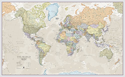
This giant world map poster mirrors the mega-scale design with a 46 x 80 inch footprint and a 1:20m scale. Its classic styling uses distinct color tones to separate countries, making it a versatile décor piece that blends with various interiors—from classrooms to family rooms. The map is laminated through heat sealing, providing durability and a smooth writing surface for classroom activities, note-taking, or geography review sessions.
48×78 World Classic Premier Wall Map Mega Poster Laminated

This 48 x 78 inch world map offers two-sided lamination with 3 mil clear film on both sides, providing dry-erase capability and extended durability. The two-sided lamination (front and reverse) makes it particularly suitable for classrooms that use map work on both sides of a wall or for teachers who rotate between different display sides. Its bold, large format supports quick recognition of continents, countries, and capitals during lessons or group activities.
Swiftmaps 32″ x 50″ RMC Large World Wall Map Poster

This 32 by 50 inch world map is up-to-date with current country boundaries, ensuring accuracy for learners. The map is laminated on both sides with a durable 3 mil layer, making it ideal for dry-erase use and long-lasting classroom display. The medium-to-large size is well-suited for mid-sized classrooms or homeschooling spaces where a durable, writable map is needed without overwhelming the wall.
24×36 World Classic Premier Wall Map Poster
This 24 x 36 inch world map poster offers a compact, durable option with 3 mil lamination for dry-erase use. It’s ideal for smaller study spaces, home classrooms, or personal rooms where space is at a premium. Despite a smaller footprint, the map preserves clear color-coding and territorial boundaries, enabling effective geography learning and quick reference for students and adults alike.
Laminated World Map & US Map Poster Set
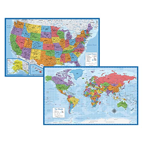
This laminated poster set includes a world map and a United States map in an 18 x 29 inch format. The two-poster bundle provides a versatile solution for classrooms or home study areas, offering a compact yet informative overview of global and domestic geography. The laminated finish increases durability and makes it suitable for dry-erase activities, quizzes, or label-building exercises.
Buying Guide
Key considerations help you choose the best large wall map for your space and learning goals:
- Size and wall space: For expansive classrooms or large living areas, opt for 46 x 80 inch maps to maximize legibility from across the room. Smaller spaces can still benefit from 24 x 36 inch or 32 x 50 inch formats without overwhelming the wall.
- Lamination and durability: Double-sided or high-quality lamination (3 mil or thicker) supports dry-erase use, long-term durability, and cleaner maintenance. Map options with heat-sealed lamination tend to resist wear in busy teaching environments.
- Orientation and layout: Classic political maps with distinct country colors help learners distinguish borders, while maps with hill shading offer a sense of terrain. Consider whether you need topographic cues or a straightforward political focus.
- Write-on capability: If you plan to annotate lessons or track changes, choose laminated sheets that accept whiteboard markers and wipes clean easily.
- Color scheme: Vibrant colors improve readability for students and viewers. Choose a design that complements your room décor while maintaining clear contrast for legibility from a distance.
- Educational content: Some maps include additional information such as capitals, flags, or “50 Interesting Facts” sections. Decide if these extras align with your curriculum or home-learning goals.
- Budget and assembly: Large maps may arrive rolled or flat. Consider ease of mounting, framing options, and whether the map’s weight influences hardware choices for wall installation.
- Usage context: For classrooms, durability and the ability to reuse across multiple lessons matter. For home offices or study corners, decorative appeal and accurate, up-to-date boundaries can be a priority.
Across these options, you’ll find a balance between visual impact and practical usability. If you need a bold, community-wide display for a learning environment, the 46 x 80 inch giants offer striking presence and write-on flexibility. For more mobility and smaller walls, the 24 x 36 inch or the 32 x 50 inch maps provide clear geography without dominating the space. When selecting, verify the latest edition or update status to ensure current country names and borders are reflected.